NASA and NOAA have put together an updated cloud-free view of Earth at night.
I found this image of North America illuminating (no pun intended).
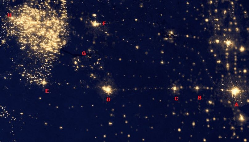
Zooming in on North Dakota:

A marks Fargo-Moorhead
B marks Valley City
C marks Jamestown
D marks Bismarck-Mandan
E marks Dickenson
F marks Minot
G marks Lake Sacacawea
H marks Williston
And Holy Jesus what the Hell are all those lights in the northwest part of the state? That's all oil exploration, baby. Wells and drilling rigs and support facilities of every imaginable kind. All built within the last seven or eight years. And if the international price of oil drops below $68 a barrel, all those lights will go out virtually overnight.
I found this image of North America illuminating (no pun intended).
Zooming in on North Dakota:

A marks Fargo-Moorhead
B marks Valley City
C marks Jamestown
D marks Bismarck-Mandan
E marks Dickenson
F marks Minot
G marks Lake Sacacawea
H marks Williston
And Holy Jesus what the Hell are all those lights in the northwest part of the state? That's all oil exploration, baby. Wells and drilling rigs and support facilities of every imaginable kind. All built within the last seven or eight years. And if the international price of oil drops below $68 a barrel, all those lights will go out virtually overnight.

Comment